A new winter storm is expected to bring over half a foot of snowfall to certain areas along the East Coast.
According to the National Weather Service, the system is expected to reach the mid-Atlantic region by late Wednesday afternoon, February 19. It will persist through Thursday, February 20.
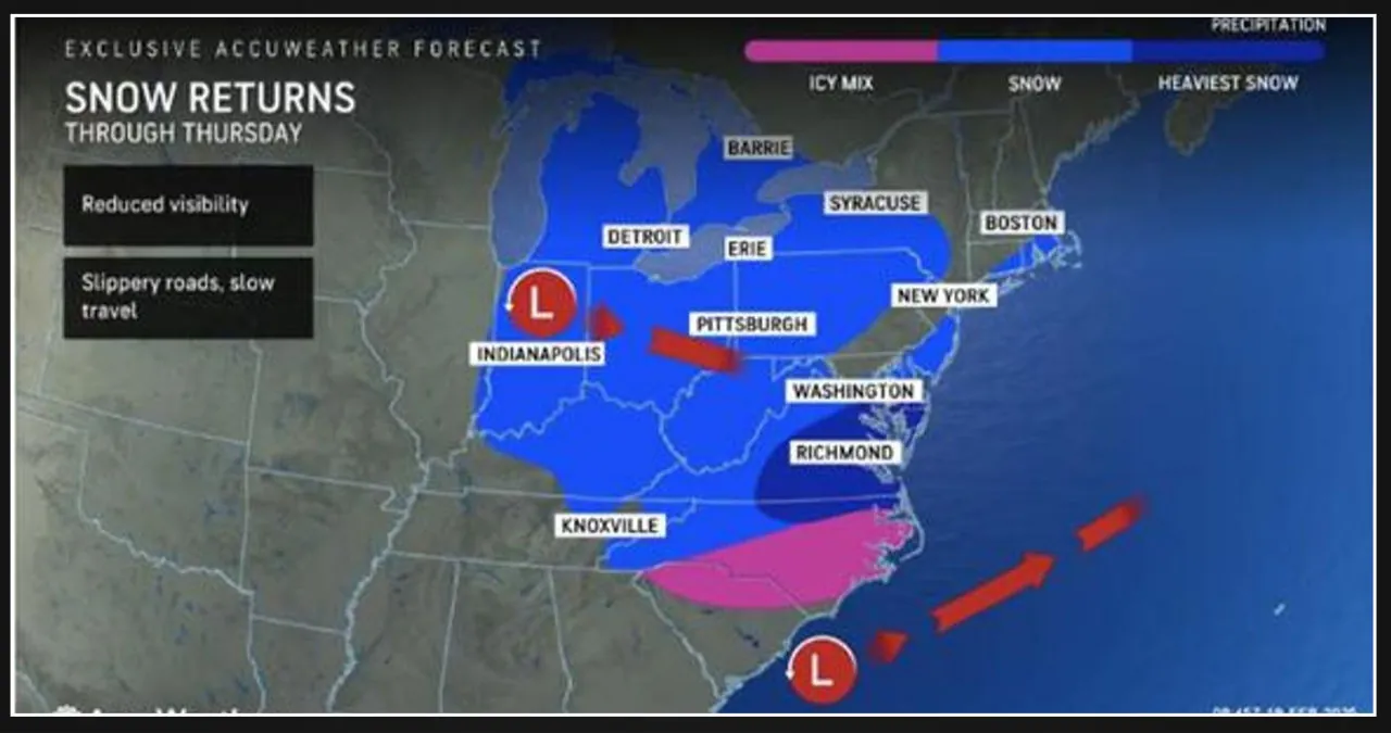
Accumulations of snow are expected to be substantial in certain areas of Virginia, Maryland, Delaware, and North Carolina, as indicated by the dark blue shading in the first image from AccuWeather.
Snowfall is expected to occur over a wider region, with intermittent periods of snow and snow showers. (Click on the second image above.)
“Some snow will extend north and west of this area, while icy conditions occur just to the south,” according to AccuWeather. “While the storm will fail to make a northward turn along the Atlantic Coast, it will still deliver the biggest snowfall of the season for some areas before heading out to sea.”
To access the most recent accumulation projections, simply click on the third image displayed above, which was released on Wednesday morning.
-
- Areas in the darkest shade of blue: More than a foot of accumulation is anticipated.
- Next lightest shade: 6 inches to 1 foot of snow is projected.
- Lightest shade: Expect 1 to 3 inches of snow.
Temperatures will gradually return to more seasonable levels in the coming days, accompanied by dry weather throughout the weekend, following the departure of the storm from the coast.