The forecasted snowfall amounts have been revised upwards for an upcoming winter storm, which is expected to result in significant snowfall, with certain areas receiving up to twelve inches of accumulation. Additionally, hazardous ice conditions are anticipated as well.
According to the National Weather Service, a fast-moving system is expected to arrive on Saturday night, February 8, before tapering off in the late morning of Sunday, February 9.
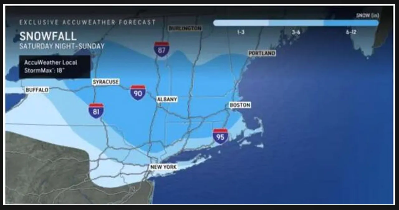
AccuWeather has released the latest predicted snowfall totals, and you can view them by clicking on the first image above. The updated forecasts were made available on Saturday morning.
-
- 1 to 3 inches in the lightest shade of blue,
- 3 to 6 inches in the next shade,
- 6 to 12 inches in the darkest shade.
“Much of the snow will fall in a six- to 12-hour period from late Saturday to Sunday morning,” AccuWeather says.
Click on the second image to see the areas where there will be a predominantly wintry mix, including the possibility of significant icing that may cause power outages.
To identify the areas that are most susceptible to power outages, simply click on the third image above.
The most significant risk of icing, says AccuWeather Senior Meteorologist Bill Deger, “lies across a swath of eastern West Virginia, far northwestern Virginia, Maryland and south-central Pennsylvania, where more than 0.25 of an inch of ice buildup is expected. This can again lead to downed tree limbs and power outages,”
To view the different types of precipitation based on specific regions, simply click on the fourth image above.
The upcoming week is expected to bring a series of storms, starting with one on Tuesday, February 11. This will kick off a period of unsettled weather, with two more systems following closely behind.