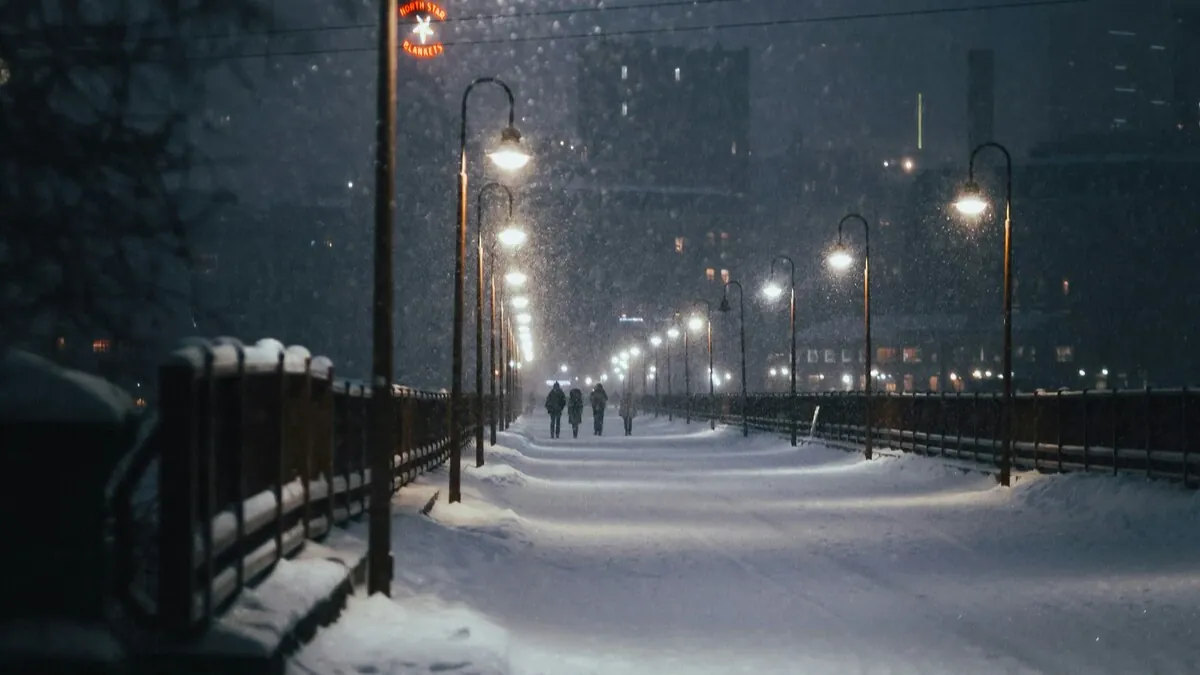
Winter’s Chill Grips the U.S. as December Begins with Snow and Freezing Temperatures
As December ushers in meteorological winter, the U.S. is experiencing a powerful winter storm marked by cold temperatures, brisk winds, and widespread snow showers. While astronomical winter doesn’t officially begin until December 21, the shift in the seasons has been felt across much of the northern and central U.S., as lake-effect snow and separate storms have triggered accumulating snowfall.
A Bitter Start to December
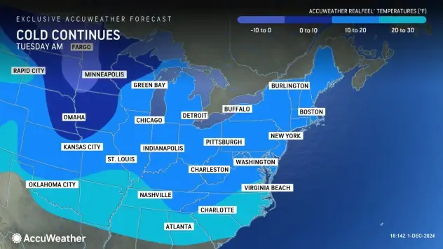
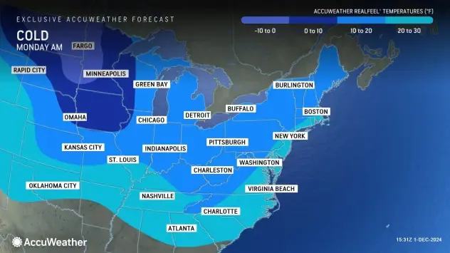
AccuWeather’s RealFeel® temperatures early on Monday morning ranged from subzero readings in the Dakotas and western Minnesota to the teens in the central Plains, Ohio Valley, Northeast, and New England states. Even southern regions like Oklahoma, the Tennessee Valley, and the Carolinas saw temperatures between 20-30°F.
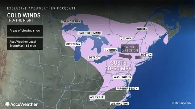
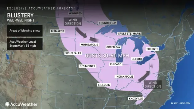
As the workweek progresses, winds will pick up in the Midwest and Northeast, making the cold feel even more intense. Gusts of 30-50 mph are expected as a storm system moves south from Canada across the Great Lakes, resulting in blowing snow and reduced visibility. These blustery conditions are forecast to continue into Thursday, shifting eastward into the mid-Atlantic and Northeast.
Lake-Effect Snow and Ongoing Cold
The westerly winds over the Great Lakes will bring additional rounds of lake-effect snow throughout the week, especially in northern Wisconsin, Michigan, and northern Ohio. Forecasters predict that these regions will continue to experience gusty winds and snowy conditions well into the latter half of the week.
This year’s early December is notably colder than last year, when cities like Chicago, Detroit, and Pittsburgh saw temperatures in the 40s and 50s. This year, high temperatures in these areas are expected to stay in the 20s and 30s, marking a sharp contrast to the milder conditions of 2023.
Cold Air to Reach the Southeast
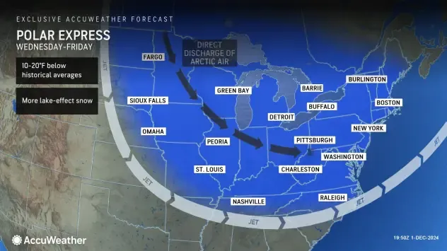
The cold front is expected to push southward, bringing sub-freezing temperatures to the Southeast, including northern Florida, though central Florida should remain above freezing. The cold wave is anticipated to continue through the weekend, with temperatures across the Plains, Northeast, and Tennessee Valley averaging 8-15°F below normal.
AccuWeather Senior Meteorologist Paul Pastelok warned that another surge of bitterly cold air is likely to arrive late in the week, focusing on the upper Midwest, Great Lakes, and Northeast, with temperatures retreating toward Canada by mid-December.
Residents across these regions, particularly in the Southeast, are urged to prepare for an early-season cold snap. While central Florida may remain unaffected, the chilly temperatures will likely impact areas known for citrus and vegetable farming.

