A new winter storm is set to move through the Northeast over the weekend, bringing snowfall to a wider region.
According to the National Weather Service, the system is predicted to arrive in the early afternoon on Saturday, Feb. 15. Precipitation is expected to persist through the overnight into Sunday, Feb. 16.
A mix of rain, snow, and ice is expected to occur from New York City, northern New Jersey, and Pennsylvania to upstate New York and New England. According to AccuWeather, areas from Washington, DC to Philadelphia will primarily experience rainfall.
On Sunday, even the northernmost locations will experience temperatures in the 40s, leading to a change in precipitation from snow to rain.
AccuWeather has just released its latest snowfall predictions on Thursday morning, February 13th. The updated forecast indicates that accumulating snow is now expected in areas that were initially not anticipated, particularly in New Jersey and Pennsylvania. This latest update reveals a southward shift in the projected snowfall.
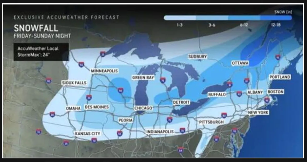
Snowfall Projections:
-
- 1 to 3 inches – Lightest shade of blue
- 3 to 6 inches – Medium shade of blue
- 6 to 12 inches – Darkest shade of blue
On Valentine’s Day, there will be a break from the weekend system and a midweek storm that will move away from the East Coast on Thursday. The weather on Friday, February 14 will be sunny with temperatures in line with the season, just before the next storm arrives.
The active February pattern is set to continue, as another potential winter storm looms for the middle of next week. (Click on the second image above.)
AccuWeather Chief On-Air Meteorologist Bernie Rayno predicts that a significant storm is likely to occur next week. This is attributed to the powerful influx of Arctic air over the northern Plains. The key question now is whether this storm will follow a path along the Atlantic coast or veer eastward, crossing the Southern states before moving out to sea.