Southern California is bracing for a fierce return of fire risk, with the National Weather Service issuing its most severe warning for extreme weather.
Destructive Santa Ana winds, with gusts of up to 100 mph expected, began Monday, raising concerns about widespread and uncontrollable wildfires, according to the FOX Forecast Center.
On Monday afternoon, a fresh brush fire broke out in Poway, California, north of San Diego. Firefighters responded quickly to the brush fire. Officials have yet to confirm the size of the fire.
The City of Poway posted a message on X announcing the evacuation of residents near the fire.
Sections of the San Gabriel Mountains in Los Angeles County saw gusts of 90 mph on Monday afternoon.
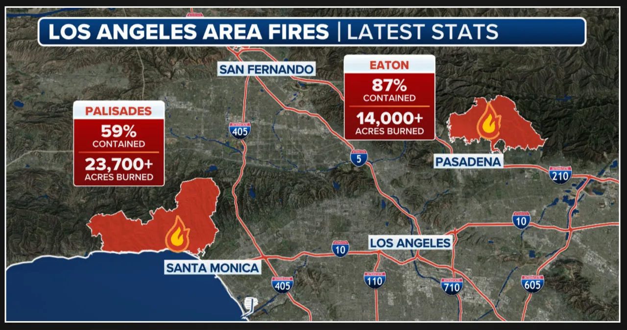
Since January 7, the Palisades and Eaton fires have destroyed over 14,000 structures, making it one of the most costly disasters in US history. The Palisades Fire has burned about 24,000 acres and is 56% controlled. The Eaton Fire has scorched more than 14,000 acres and is 81% controlled.
“The return of Santa Ana winds in the forecast presents a significant concern,” stated FOX Weather Meteorologist Craig Herrera. “Remember, containment means they have encircled the fire.” However, once the winds return, some of the embers may jump the fire lines, so they must exercise caution.
Between midday Monday and Tuesday at 10 a.m., the National Weather Service issued a “Particularly Dangerous Situation” Fire Weather Warning for a wide area of Los Angeles and Ventura counties.
“Take action now to prepare your home and loved ones for another round of EXTREME WIND and FIRE WEATHER,” according to the Weather Channel.
Following a much quieter weekend, Southern California is experiencing a significant shift in weather patterns, according to the FOX Forecast Center. The base of a very long, severe dip in the jet stream is approaching the state, bringing cold air and strong upper-level winds. The offshore flow will increase dramatically as the base of the jet stream dips around Southern California and winds blow in from the northeast.
Northeasterly winds will pick up in the morning on Monday and accelerate as they move away from the highlands and toward the shore. Wind gusts will begin to build, reaching 65 mph on the valley floor and 100 mph at the higher mountains.
These gusts will blow from the northeast, as is typical of Santa Ana winds. The San Fernando and Santa Clarita valleys will face the most severe wind threats.
The winds will peak Monday evening and overnight but will continue until Tuesday morning.
“This is where we have the fires burning, in some cases,” Herrera informed the crowd. “Right now, critical (fire weather) extends all the way down into San Diego County, and elevated (fire weather) goes into the high deserts.”
Because of the strong winds and extremely low relative humidity levels, life-threatening fire weather conditions will develop. New or existing fire conditions pose a high risk of rapid fire spread and intense fire behavior.
Herrera declares, “We must closely monitor this situation.” Herrera advises everyone to take precautions against flames and fires, and to be ready to evacuate if necessary.
Investigators have yet to declare a cause for the massive fires that began on Jan. 7, but because of the lack of lightning in the area, agencies such as the ATF have focused on the role people may have played in igniting the conflagration.
A congressional assessment found that humans caused 89% of the country’s wildfires between 2018 and 2022, with debris burns, utility equipment, and arson serving as common ignition sources.

