The National Weather Service (NWS) issued severe thunderstorm warnings for parts of Texas and Oklahoma on Tuesday. Meteorologists emphasized the potential impacts of hail and lightning.
Why It Matters
This Article Includes
Severe weather has the potential to create dangerous situations, including flooding, road closures, power outages, and property damage.
People living in areas affected by severe weather conditions should stay updated with the latest weather updates and be ready to take immediate action in response to emergency alerts.
What To Know
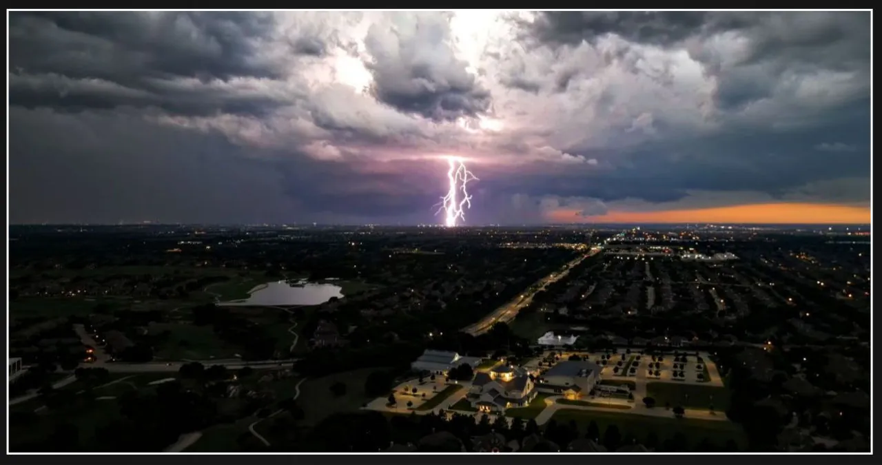
According to the NWS forecast office for Fort Worth-Dallas, a potent storm system is predicted to bring thunderstorms to certain parts of the area from late Monday night through Tuesday morning.
The forecast predicts that the primary risks will be destructive straight-line winds and short-lived tornadoes. Additionally, there is a chance of scattered areas of significant hail, especially in storms that develop ahead of or preceding the main line.
Residents in the affected areas should be prepared for possible disruptions to their Tuesday morning commute, according to the advisory.
Severe thunderstorm warnings were in effect across the Fort Worth-Dallas area and extended northwards into south central Oklahoma, as of early Tuesday morning. These warnings are issued by the NWS when severe thunderstorms are occurring or imminent.
The warning extended to several counties in Texas, including Montague, Cooke, Grayson, Wise, Denton, Parker, Tarrant, Dallas, Hamilton, Coryell, Lampasas, and Mills.
The National Weather Service (NWS) has issued warnings for several counties in Oklahoma, including Johnston, Garvin, Love, Carter, Pontotoc, Marshall, and Murray.
The National Weather Service issued a warning for residents, cautioning them to prepare for potential damage caused by penny-sized hail and wind gusts reaching up to 60 mph. They specifically advised residents to anticipate damage to roofs, siding, and trees.
In addition to the severe thunderstorm warning, there were also tornado watches in effect for northeast Texas and southeast Oklahoma. These watches are issued when there is a possibility of severe thunderstorms and tornadoes in the designated area.
What People Are Saying
According to AccuWeather meteorologist Brandon Buckingham, severe thunderstorms are still a concern in some parts of far eastern Texas until early afternoon. However, the main focus of the risk will be on the lower Mississippi Valley and the South as the line of storms moves eastward throughout the day and into tonight.
The NWS forecast office in Norman, Oklahoma, shared on X, formerly known as Twitter, Tuesday: “At 12:07 a.m., a line of strong/severe storms is currently progressing through parts of OK and north TX. This line has the potential to bring hail, strong wind gusts, and possibly a few tornadoes as it moves east.”
According to NBC meteorologist Kevan Smith on X, he advises everyone to stay weather aware for Tuesday morning due to the expected movement of a line of thunderstorms across North Texas. The forecast includes the possibility of damaging winds, large hail, and a few tornadoes.
Fox 35 meteorologist Noah Bergren promptly reported on X that the bomb-cyclone has commenced as predicted, resulting in severe storms across Oklahoma, Texas, and Kansas. The lightning activity during this event has been astonishing, with an estimated count of over 4,000 individual bolts in the past half hour alone. Tornado Warnings have now been issued, and there is a nocturnal tornado risk from OKC to Dallas as we head into daybreak on Tuesday, local time.
What Happens Next
Severe thunderstorm warnings are currently in effect until 5:45 a.m. CST.
The National Weather Service (NWS) has issued tornado watches for the Fort Worth and Dallas areas, which will be in effect until 11 a.m.
The weather service frequently provides updates on its website regarding the forecast.