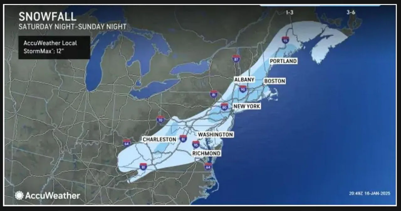
A layer of snow, ranging from a few inches in some areas to as much as a coating in others, is expected to stretch from the southern Appalachians to the mid-Atlantic coast on Sunday afternoon, January 19. The snowfall is predicted to continue into central and southeastern New England on Sunday evening, lasting through early Monday, January 20, coinciding with the celebration of Dr. Martin Luther King Jr. Day.
“This means there is the risk of snow-covered and slippery roads from parts of Interstate 77 in North Carolina to I-95 in New England for the latter part of the weekend,” according to AccuWeather. “This includes the metro areas of Washington, DC, Baltimore, Philadelphia, New York City and Boston. Expect significant delays even if only a small amount of snow accumulates.”
The image above shows that the areas in the darker shade of blue are expected to receive several inches to up to a half-foot of snowfall. On the other hand, the areas in the lighter shade should expect an accumulation of 1 to 3 inches of snow.
Skies will clear at the end of the workweek on Friday, Jan. 17, and there will be a slight increase in temperatures. Highs are expected to reach the upper 30s.
Expect mostly cloudy conditions throughout the day as the skies become overcast overnight. This weather pattern paves the way for a potential snow system that could impact parts of the Northeast and Midwest on the night of January 18th. Please refer to the second image above for further details.
Sunday will begin with partly sunny skies, but clouds will gradually increase as a storm system moves from the south to the north. It is still too early to determine the potential snowfall amounts at this time.

