Forecasters are warning that certain areas may see snow and sleet accumulation as precipitation shifts west of I-81 before dawn on Saturday, February 8th.
The forecast indicates that snowfall is anticipated to begin and later change into sleet, eventually transitioning into freezing rain as the afternoon progresses.
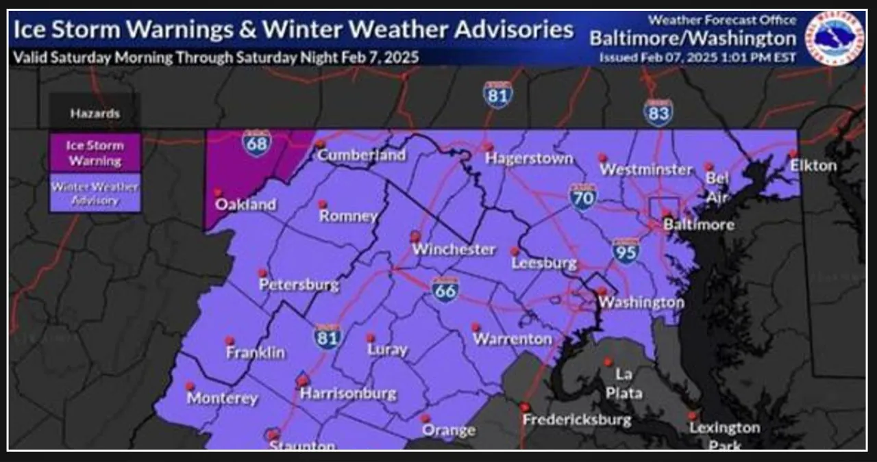
According to the National Weather Service, the area will experience a wintry mix on Saturday morning. This mix may begin as a combination of snow and sleet before transitioning into freezing rain, which will continue throughout the evening.
With the recent icing event, there is a possibility that trees may become stressed if another icing event occurs. This could lead to more downed trees, power lines, and power outages.
Officials are advising motorists that road conditions are expected to be slippery, and they are discouraging travel during the upcoming storm.
“If you need to travel, it’s important to have an extra flashlight, food, and water in your vehicle in case of an emergency,” they advised. “We strongly advise against traveling because of the hazardous road conditions and the potential for fallen trees and power lines.”
According to AccuWeather, although the I-95 corridor from Washington, DC, to Philadelphia won’t experience significant snow and ice, there could still be some slippery travel on Saturday and Saturday evening due to a mix of snow, sleet, and freezing rain at the beginning.
On Saturday, temperatures are expected to experience a temporary increase before dropping back down to freezing levels. This situation creates the potential for refreezing, especially with wind gusts reaching up to 20 mph in the region.
As temperatures rise on Sunday morning, we can expect an improvement in road conditions.