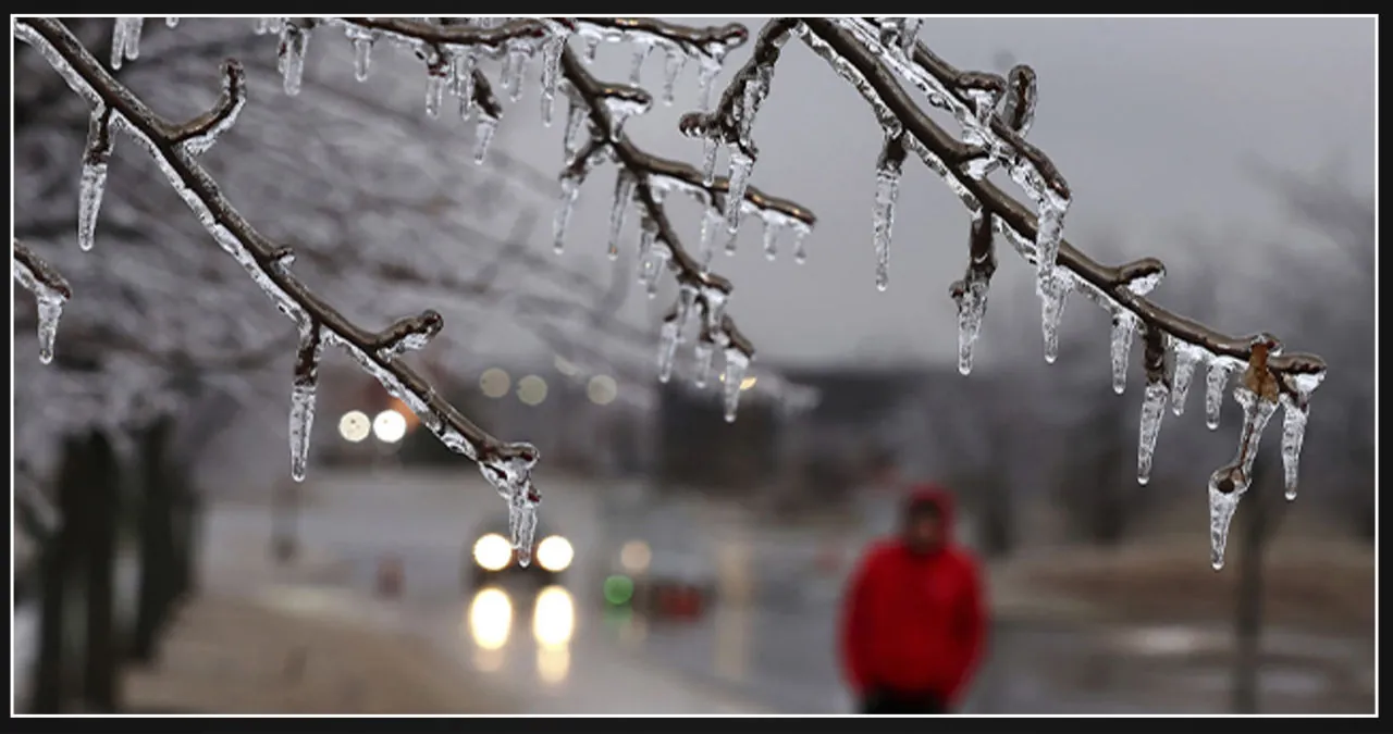
A winter storm is currently developing and millions of people from the Midwest to the Northeast are being warned about the potential dangers it may bring. This storm has the potential to create a significant ice threat, posing risks such as power outages and hazardous travel conditions throughout the region.
Computer forecast models are now in agreement that the storm, which is part of a series of powerful atmospheric river storms currently impacting the West Coast, will begin to form over the Plains on Wednesday. As it progresses eastward across the United States, it is expected to gain strength.
As the system continues its eastward movement, a powerful southerly jet stream will come into play, ushering in warm and moisture-laden air across the eastern portion of the country.
A warm front will develop, creating a separation between subfreezing air to the north and record-breaking warmth to the south.
The problem lies in the fact that warm air will ascend above a thin layer of below-freezing air close to the surface.
According to the FOX Forecast Center, a significant area of freezing rain is expected to occur from Iowa to New England. This freezing rain is projected to have a notable impact.
The warmer air aloft will be so powerful that snowfall will be limited to northern Minnesota, Wisconsin, and Michigan, according to the FOX Forecast Center.
Freezing rain is forecast to begin in the mid-Mississippi Valley on Wednesday afternoon and spread to the Great Lakes by Wednesday night.
Parts of Missouri and Illinois have already received winter weather advisories due to the approaching storm.
The National Weather Service office in St. Louis has encouraged residents to prepare for potential effects.
“Slow down and use caution while traveling,” forecasters advised. “Prepare for possible power outages.”
The Thursday morning commute is likely to be exceedingly perilous on untreated roads in locations such as Chicago, Fort Wayne, Indiana, and Columbus and Cleveland, Ohio.
Areas to the east are predicted to receive more heavy icing, particularly western Maryland and Pennsylvania’s Laurel Highlands.
The region, including Clarion, Altoona, and Bedford in Pennsylvania, has issued winter storm watches.
Power outages and tree damage are most possible in those locations owing to ice accumulation of more than a quarter inch.
Outside of that area, freezing rain is anticipated to fall along the important Interstate 95 corridor from Washington to southern New England.
According to the FOX Forecast Center, the cold air from the New York City area northward will be deep enough to cause snow with the commencement of winter weather.
Cities like New York City, Hartford, Connecticut, and Boston may get snowfall during the Thursday morning commute.
That might cause havoc on the roads, but the FOX Forecast Center predicts that, as in the Midwest, warm air will move in, turning the snow into freezing rain or plain rain.
Any remaining snow will almost completely melt.
However, farther north in northern New England, snow will continue throughout the day on Thursday and may not alter north of Interstate 90.
According to the FOX Forecast Center, regions with 6 inches or more of snow will most likely be located there.
The system will then quickly leave New England by Thursday evening, leaving mostly dry conditions for Thursday night and Friday.
However, another snowstorm could hit many of the same places this weekend.